QLandkarteGT
An excellent program in order to view your actual environment from a bird's perspective OFFLINE on any netbook or similar is QLandkarteGT, a moving map application. It is open source and comes as Linux (integrated in ubuntu 10.4), Windows or Mac program (download binaries, there even exists a portation for mobile computers), and works together with any NMEA-driven gps-mouse (I had to manipulate my mouse first). With QLandkarteGT you create your own GeoTIFF-maps from any source, if you know how to set the reference points. And that's where MobileAtlasCreator comes into play.
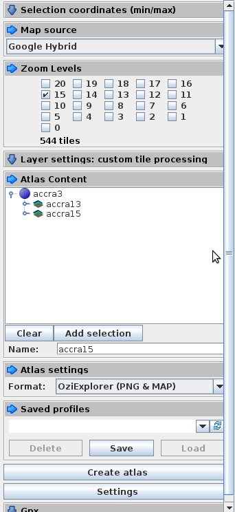
So how to get maps into QlandkarteGT with MobileAtlasCreator? First start Mobac and select a map source and a region. Let's say you want three different zoom levels of that region, so add three atlas contents with three different zoom levels, respectively, by pressing the "add selection"-button.
Choose as atlas settings "OziExplorer (PNG & MAP)" and create your atlas.
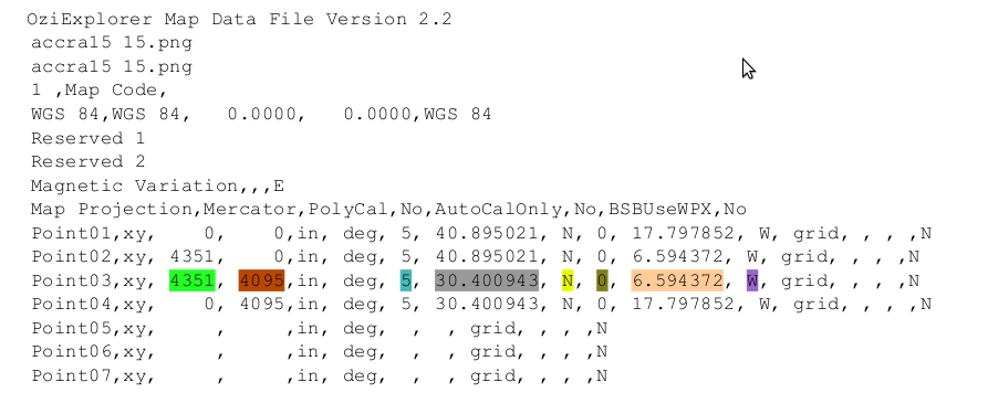
Open a map file (you will have one in every subdirectory) in any editor. It'll look something like this:
Then you have to create a file with ending "gpc" (accra15.gpc, for example) in any editor, It should look like this:
Look at the colors, then you will see how to use the information of the map file. The first two lines can just be copied if you have WGS84 mercator projection:
#V1.0
-a_srs +proj=merc +a=6378137.0000 +b=6356752.3142 +towgs84=0,0,0,0,0,0,0,0 +units=m  +no_defs
-gcp
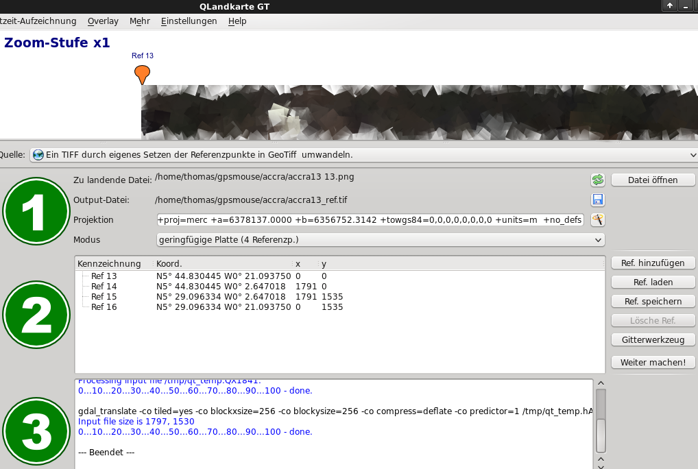
Now open QLandkarteGT, press F1, then F6. Select "Create a TIFF by setting referencepoints" (or similar, it's german on my computer). Choose one of the png-files
mobac created (don't care that a tif-file is expected), tell QLandkarte, you have 4 reference points and load your reference points by selecting the appropriate
gpc-file previously created. Go on the same steps with all your maps of different zoom levels.
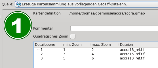
If you are finished with all maps, select another source, something like "Create map collection from available geotiff-files". Here you add
your different maps starting with the most detailed scale.
Save. That's it. Now you have a scaleable offline map. Be sure to leave the qmap-file and the tif-files within the same directory. Enjoy.
--Nchn 21:40, 19 August 2010 (UTC)


